Komatsu is using construction of its mining company’s future Milwaukee headquarters as an incubator for new smart technology to guide its earth-moving equipment.
That Komatsu construction technology debuted in early March at the CONEXPO-CON/AGG 2020 trade show in Las Vegas. Wisconsin contractors are using that technology now as they dig foundations and move dirt for new office and manufacturing facilities for Komatsu Mining Corp.’s new headquarters in Milwaukee’s Harbor District.
“We can be a little more aggressive and bring prototype or beta versions of these technologies to bear, because we are owner and provider,” said Jason Anetsberger, senior product manager for Komatsu America Corp.
See the attached slideshow for photos taken Tuesday at Komatsu Mining’s Milwaukee construction site.
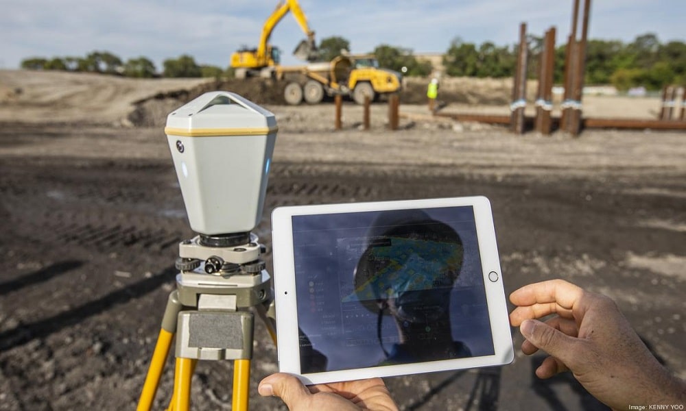
The smart construction system grew out of Komatsu technology that uses three-dimensional models to guide on-site heavy equipment and operators. The machines have engineering models showing operators if they’re digging in the right place, and to the right depth, for example.
That Komatsu technology has been around since 2013, but the new systems expanded collection and sharing of data on site. The more exact quantities from that data results in better planning, less estimating, and less costly down time.
“We can use that data elsewhere, not just in the machines and how they move the earth, but also in these solutions to track progress, to compare the design versus actual conditions on the job site,” Anetsberger said. “We’re talking about stuff that, before, we wouldn’t necessarily, things that were difficult to measure or maybe not worth the time to measure.”
As the data technology improves over time, it could be used to automatically recommend the number of excavators needed to accomplish a job, or even to further automate that equipment, Anetsberger said.
“It is a long journey, but if you look at where we are at today versus one year ago, even 10 years ago, we’ve come far,” Anetsberger said. “There’s lots of room to go further. It all starts with having the plans in 3-D and having the data measurements in 3-D.”
Brookfield-based Cornerstone One, which is handling footing and foundations on the Komatsu Mining buildings, used the tech to advance data collection on-site and sharing of that data with planners in the home office. Systems of satellites and sensors let the excavators measure the location, depth of the dig and other details for new building foundations.
As with other projects, three-dimensional models are created before the digging starts to estimate work costs and scheduling. But, as with every project, they’re subject to change once crews break ground and see what’s really under the surface, said Steve Adkins of Cornerstone One.
“It’s great we can build a really nice model virtually and we can put all of the parameters in there, but the reality is the only things consistent in construction is change,” Adkins said.
The tech smooths out disruptions when that change occurs on the Milwaukee project, Adkins said. One example on the Komatsu site is operators discovering there’s more rubble on the project site than expected, so they must dig deeper to reach bedrock for building foundations.
Instead of sometimes spending days on trips between the site and office to update the plan if the bedrock is four feet deeper than expected, it can be done in hours, Adkins said. Real-time data is sent to engineers in the office who update the project plan, and transmit back to the diggers in the field to help guide the excavator operators.
That exchange of data improves scheduling and also can update invoices to Komatsu Mining when higher-than-expected digging costs arise.
“It provides certainty for me as a contractor because I know we are going to get paid for the amount of extra work that we have, and it provides that confidence for the owner,” Adkins said.
Racine-based site grading contractor A.W. Oakes & Son Inc. is also using drones to fly and photograph the site weekly, creating more information than is available from the sensors on the excavator equipment. Those images are used to track quantities of materials in piles on the property, and the locations and size of areas where digging has occurred and where grass seeding eventually will be needed.
The drones mean surveyors don’t have to walk the site, which has safety benefits, especially in the era of Covid-19, said Kevin Hokanson, A.W. Oakes vice president of operations.
“We start scheduling our crews and our equipment differently on the one- to two-week look-ahead based on how much production they get or how much ground there is to move ahead of them,” Hokanson said.


